|

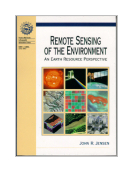
REMOTE SENSING OF THE ENVIRONMENT AN EARTH RESOURCE PERPECTIVE
JENSEN J. wydawnictwo: PRENTICE HALL , rok wydania 1999, wydanie I cena netto: 380.00 Twoja cena 361,00 zł + 5% vat - dodaj do koszyka John R. Jensen ,
University of South Carolina
Published January 2000 by
Engineering/Science/Mathematics
Copyright 2000, 544 pp.
Cloth ISBN 0-13-489733-1
Ideal for a university level,
one-semester Introductory Remote Sensing course as well as an Introductory Airphoto
Interpretation course.
This book introduces the
fundamental principles of remote sensing from an earth resource perspective. It reviews
the nature of electromagnetic radiation and how the reflected or emitted energy in the
visible, near-infrared, middle-infrared, thermal infrared, and microwave portions of the
spectrum can be collected by a variety of sensor systems and analyzed. Emphasis in this
book is placed on manual, visual image analysis of the remote sensor data using
introductory photogrammetric techniques. This book is a companion volume to Dr. Jensen's
widely-adopted Introductory Digital Image Processing (Prentice-Hall, Inc., 2nd Edition,
1996).
Documents the history of
photography and other remote sensing detectors, and aerial platforms (balloon, kite,
aircraft, satellite) so that the reader can appreciate the great strides that have
taken place in sub-orbital and orbital remote sensing science. a multidisciplinary
approach places emphasis on how to remotely sense fundamental biophysical characteristics
of the terrain such as precise location (x,y), height-depth (z), temperature, moisture
content, chlorophyll content, surface roughness, etc., for vegetation, soils, minerals,
water, ice and the atmosphere.
Enables readers from many
disciplines such as geography, agriculture, forestry, marine science, and geology to adapt
the remote sensing principles and technology to their own application.
Provides case studies in
most chapters that demonstrate the proper application of remote sensing principles and
technology.
Includes hundreds of
specially designed illustrations that communicate principles in an easily understood
manner. The large 8 1/2 x 11 in. format with 32 pages of color facilitates image
interpretation.
Instructors may obtain
encapsulated postscript files of each of the illustrations in the book from a
Prentice-Hall, Inc. web site for creation of their own slides or viewgraphs
(www.prenhall.com/jensen).
1. Remote Sensing of the Environment
2. Electromagnetic Radiation Principles
3. History of Aerial Photography and Aerial Platforms
4. Aerial Photography - Vantage Point, Cameras, Filters, and Film
5. Elements of Visual Image Interpretation
6. Photogrammetry
7. Multispectral Remote Sensing Systems
8. Thermal Infrared Remote Sensing
9. Active and Passive Microwave, and LIDAR Remote Sensing
10. Remote Sensing of Vegetation
11. Remote Sensing of Water
12. Remote Sensing the Urban Landscape
13. Remote Sensing of Soils, Minerals, and Geomorphology
Index
Appendix A-Sources of Remote Sensing Information
Księgarnia nie działa. Nie odpowiadamy na pytania i nie realizujemy zamówien. Do odwolania !.
|


